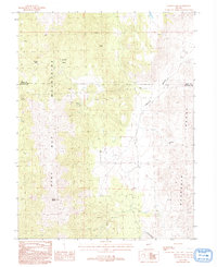
1987 Map of Mount Como
USGS Topo · Published 1993About this map
The Pine Nut Mountains and the northern reaches of the Buckskin Range dominate this interior Nevada landscape, which straddles the high-elevation boundary between Lyon and Douglas counties. This 1980s-era survey reveals a rugged terrain defined by significant mineral exploration, evidenced by numerous Prospects and individual Prospect labels scattered across the mountain flanks. These markings, along with the isolated Sunrise Camp, suggest a persistent legacy of prospecting in the high desert long after the initial regional mining booms.
Find a feature on this map
16 named features on this map. Tap any name to fly to it.
Don’t see what you’re looking for? This feature index may not catch every label — zoom into the map to look around manually.
Map Details
Editions of this 1987 Mount Como Map
2 editions found
Other maps of this area

1889 · Markleeville
USGS Topo · 1:125,000

1891 · Carson
USGS Topo · 1:125,000

1891 · Markleeville
USGS Topo · 1:125,000

1891 · Wabuska
USGS Topo · 1:125,000

1891 · Wellington
USGS Topo · 1:125,000

1893 · Carson
USGS Topo · 1:125,000

1893 · Markleeville
USGS Topo · 1:125,000

1893 · Wellington
USGS Topo · 1:125,000

1894 · Wabuska
USGS Topo · 1:125,000

1948 · Walker Lake
USGS Topo · 1:250,000