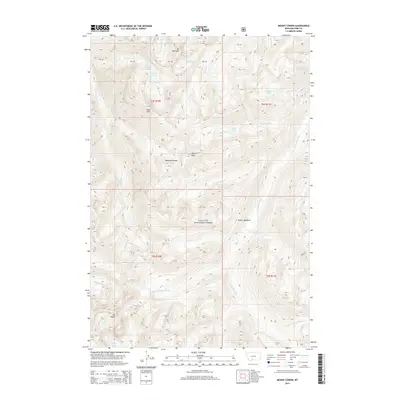
2014 Map of Mount Cowen
USGS Topo · Published 2014About this map
Mt Cowen and the high peaks of the Absaroka Range dominate this high-elevation wilderness within the Gallatin National Forest. The landscape is defined by steep glacial cirques and numerous alpine water bodies, including Jewel Lake, Pine Cr Lake, and Lake McKnight. The complex drainage patterns of the W Boulder River and its various forks, such as the W Fork W Boulder River, carve through the terrain, illustrating the high-altitude hydrology of the Park County backcountry. Geodetic markers and land partitions like PB 40 and PB 39 are interspersed among landmarks like Black Mtn and Marten Peak, providing precise reference points for researchers and mountaineers navigating this section of the Montana wilderness.
Find a feature on this map
35 named features on this map. Tap any name to fly to it.
Don’t see what you’re looking for? This feature index may not catch every label — zoom into the map to look around manually.
Map Details
Editions of this 2014 Mount Cowen Map
This is the sole edition of this map. No revisions or reprints were ever made.
Other maps of this area

1891 · Livingston
USGS Topo · 1:250,000

1893 · Livingston
USGS Topo · 1:250,000

1940 · Mt. Cowen
USGS Topo · 1:62,500

1943 · Mt Cowen
USGS Topo · 1:62,500

1947 · Bozeman
USGS Topo · 1:250,000

1948 · Bozeman
USGS Topo · 1:250,000

1951 · Mount Rae
USGS Topo · 1:24,000

1951 · Brisbin
USGS Topo · 1:24,000

1951 · Livingston Peak
USGS Topo · 1:24,000

1955 · Bozeman
USGS Topo · 1:250,000