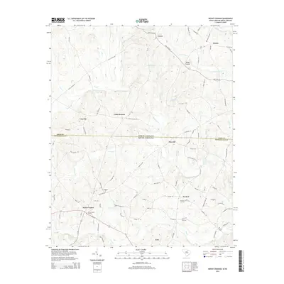
2014 Map of Mount Croghan
USGS Topo · Published 2014About this map
Mount Croghan and Ruby anchor this survey of the borderlands where the Carolinas meet. The landscape is defined by the drainage of Thompson Cr and Deep Cr, with numerous small settlements such as Maysville and Lowrys connected by a network of rural routes. For genealogists and local historians, the map is particularly useful for locating family burial grounds, including the Elizabeth Cem, Griggs Cem, and Ebenezer Cem. The transition across the North Carolina South Carolina line is clearly marked, showing the continuity of rural development across state boundaries. Landmarks such as Concordia Farms Lake and the settlement of Littles Quarters provide specific points of reference within this agricultural and wooded terrain.
Find a feature on this map
99 named features on this map. Tap any name to fly to it.
Don’t see what you’re looking for? This feature index may not catch every label — zoom into the map to look around manually.
Map Details
Editions of this 2014 Mount Croghan Map
This is the sole edition of this map. No revisions or reprints were ever made.
Other maps of this area

1941 · Spartanburg
USGS Topo · 1:250,000

1953 · Spartanburg
USGS Topo · 1:250,000

1956 · Wadesboro
USGS Topo · 1:24,000

1960 · Spartanburg
USGS Topo · 1:250,000

1963 · Spartanburg
USGS Topo · 1:250,000

1964 · Spartanburg
USGS Topo · 1:250,000

1968 · Chesterfield
USGS Topo · 1:24,000

1968 · Ruby
USGS Topo · 1:24,000

1968 · Jefferson NE
USGS Topo · 1:24,000

1970 · Marshville
USGS Topo · 1:24,000