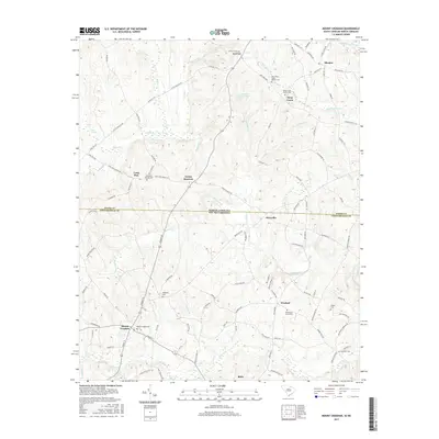
2017 Map of Mount Croghan
USGS Topo · Published 2017About this map
Mount Croghan and Ruby anchor the southern portion of this landscape, situated just below the state line where North Carolina and South Carolina meet. The geography is defined by a dense network of small watercourses, including Thompson Cr, Deep Cr, and Deadfall Cr, which drain a countryside dotted with historic family and community landmarks. Genealogists will find a high concentration of burial sites across the terrain, from Mount Croghan Cem and Elizabeth Cem in the south to the West Deep Creek Church Cem and Deep Creek Church Cem near the northern boundary. Smaller settlements such as Lowrys, Shoates, and Maysville are connected by a web of rural routes like State Rd 1217 and Jackson Rd, illustrating the persistent small-town character of Chesterfield County.
Find a feature on this map
109 named features on this map. Tap any name to fly to it.
Don’t see what you’re looking for? This feature index may not catch every label — zoom into the map to look around manually.
Map Details
Editions of this 2017 Mount Croghan Map
This is the sole edition of this map. No revisions or reprints were ever made.
Other maps of this area

1941 · Spartanburg
USGS Topo · 1:250,000

1953 · Spartanburg
USGS Topo · 1:250,000

1956 · Wadesboro
USGS Topo · 1:24,000

1960 · Spartanburg
USGS Topo · 1:250,000

1963 · Spartanburg
USGS Topo · 1:250,000

1964 · Spartanburg
USGS Topo · 1:250,000

1968 · Chesterfield
USGS Topo · 1:24,000

1968 · Ruby
USGS Topo · 1:24,000

1968 · Jefferson NE
USGS Topo · 1:24,000

1970 · Marshville
USGS Topo · 1:24,000