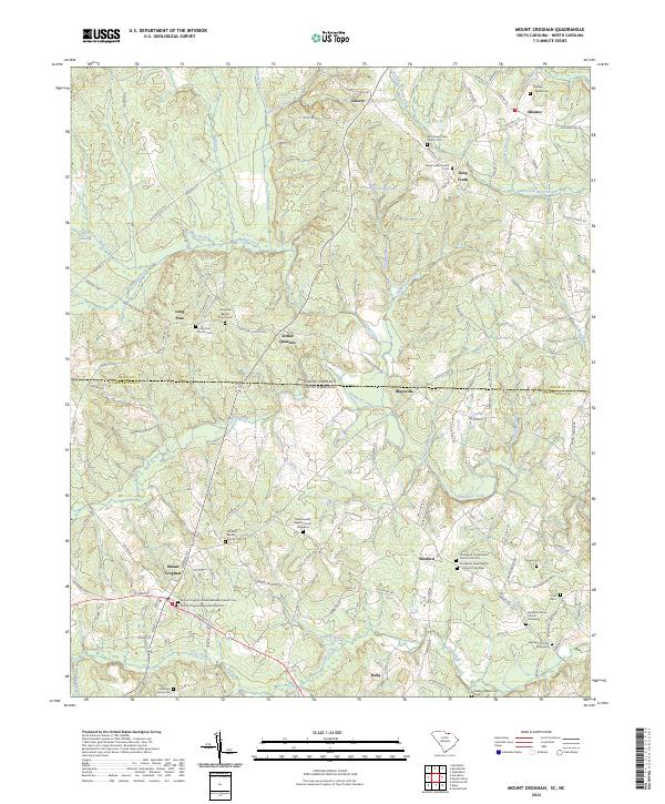
2024 Map of Mount Croghan
USGS Topo · Published 2024About this map
Mount Croghan and Ruby anchor the southern portion of this landscape, situated along a series of state roads and local tracks that cross the border between North Carolina and South Carolina. This modern topographic study reveals a rural corridor defined by deep-seated community anchors, particularly a high density of small-town churches and family burial grounds that suggest a long history of settlement. The terrain is intricately carved by several waterways, including Thompson Creek and its tributaries like Gulpins Branch and Talton Branch, which dictate the winding paths of rural roads.
Find a feature on this map
136 named features on this map. Tap any name to fly to it.
Don’t see what you’re looking for? This feature index may not catch every label — zoom into the map to look around manually.
Map Details
Editions of this 2024 Mount Croghan Map
This is the sole edition of this map. No revisions or reprints were ever made.
Other maps of this area

1941 · Spartanburg
USGS Topo · 1:250,000

1953 · Spartanburg
USGS Topo · 1:250,000

1956 · Wadesboro
USGS Topo · 1:24,000

1960 · Spartanburg
USGS Topo · 1:250,000

1963 · Spartanburg
USGS Topo · 1:250,000

1964 · Spartanburg
USGS Topo · 1:250,000

1968 · Chesterfield
USGS Topo · 1:24,000

1968 · Ruby
USGS Topo · 1:24,000

1968 · Jefferson NE
USGS Topo · 1:24,000

1970 · Marshville
USGS Topo · 1:24,000