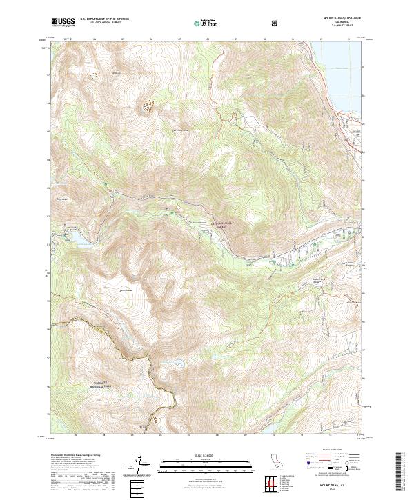
2021 Map of Mount Dana
USGS Topo · Published 2021About this map
Mt Dana and the high Sierra Nevada terrain define this landscape, where the eastern boundary of Yosemite National Park meets the Inyo National Forest. The map captures a high-altitude wilderness shaped by glaciation, evidenced by the sharp relief of Glacier Canyon and the massive Dana Plateau. Infrastructure is concentrated along the Tioga Pass Rd corridor, which follows the descent of Lee Vining Creek toward the western edge of Mono Lake. Industrial and land-management history is present through labels for the Log Cabin Mine and the Poole Power Plant, highlighting the early 21st-century balance of resource utility and preservation. Other significant markers include the Tuolumne Wild and Scenic River and specialized features like the Farrington Siphon and the Burger Natural Area near Mono Dome.
Find a feature on this map
53 named features on this map. Tap any name to fly to it.
Don’t see what you’re looking for? This feature index may not catch every label — zoom into the map to look around manually.
Map Details
Editions of this 2021 Mount Dana Map
This is the sole edition of this map. No revisions or reprints were ever made.
Other maps of this area

1901 · Mt. Lyell
USGS Topo · 1:125,000

1909 · Bridgeport
USGS Topo · 1:125,000

1911 · Bridgeport
USGS Topo · 1:125,000

1920 · Bridgeport
USGS Topo · 1:125,000

1947 · Mariposa
USGS Topo · 1:250,000

1948 · Walker Lake
USGS Topo · 1:250,000

1948 · Mariposa
USGS Topo · 1:250,000

1953 · Mono Craters
USGS Topo · 1:62,500

1956 · Matterhorn Peak
USGS Topo · 1:62,500

1956 · Tuolumne Meadows
USGS Topo · 1:62,500