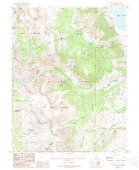
1988 Map of Mount Dana
USGS Topo · Published 1989About this map
Mount Dana and the surrounding high Sierra peaks define this 1988 landscape, where three major wilderness areas and a national park converge. This survey documents the intersection of Hoover Wilderness, Ansel Adams Wilderness, Inyo National Forest, and Yosemite National Park. The topography is dominated by dramatic elevation changes, from the shores of Mono Lake in the east to the Dana Glacier and Dana Plateau in the west.
Find a feature on this map
44 named features on this map. Tap any name to fly to it.
Don’t see what you’re looking for? This feature index may not catch every label — zoom into the map to look around manually.
Map Details
Editions of this 1988 Mount Dana Map
This is the sole edition of this map. No revisions or reprints were ever made.
Other maps of this area

1901 · Mt. Lyell
USGS Topo · 1:125,000

1909 · Bridgeport
USGS Topo · 1:125,000

1911 · Bridgeport
USGS Topo · 1:125,000

1920 · Bridgeport
USGS Topo · 1:125,000

1947 · Mariposa
USGS Topo · 1:250,000

1948 · Walker Lake
USGS Topo · 1:250,000

1948 · Mariposa
USGS Topo · 1:250,000

1953 · Mono Craters
USGS Topo · 1:62,500

1956 · Matterhorn Peak
USGS Topo · 1:62,500

1956 · Tuolumne Meadows
USGS Topo · 1:62,500