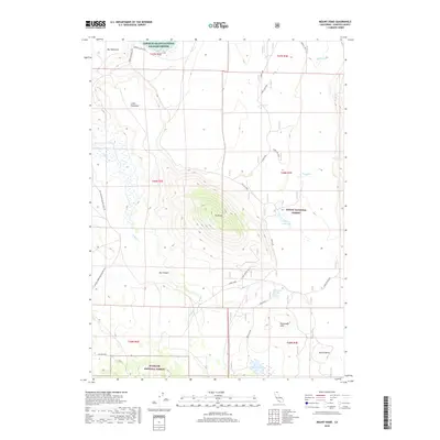
2018 Map of Mount Dome
USGS Topo · Published 2018About this map
Mt Dome stands as a prominent landmark in this section of Northern California, surrounded by a complex landscape of volcanic plateaus and seasonal water bodies. The terrain transitions from the high, flat expanses of Big Tableland and Little Tableland down to the recessed Box Canyon. Human activity in this rural pocket is evidenced by isolated points like Lairds Camp and a network of forest roads such as Gold Digger Pass and Laird Lake spur. Conservation efforts define the land use, with the area split between the Modoc National Forest, Klamath National Forest, and the northern reaches of the Lower Klamath National Wildlife Refuge. Numerous small lakes, including Sheep Camp Lake and Panhandle Lake, dot the region, indicating a basin environment where water is a critical but scattered resource.
Find a feature on this map
34 named features on this map. Tap any name to fly to it.
Don’t see what you’re looking for? This feature index may not catch every label — zoom into the map to look around manually.
Map Details
Editions of this 2018 Mount Dome Map
This is the sole edition of this map. No revisions or reprints were ever made.
Other maps of this area

1886 · Modoc Lava Bed
USGS Topo · 1:250,000

1892 · Modoc Lava-Bed
USGS Topo · 1:250,000

1950 · Mt. Dome
USGS Topo · 1:62,500

1950 · Bray
USGS Topo · 1:62,500

1950 · Dorris
USGS Topo · 1:62,500

1952 · Medicine Lake
USGS Topo · 1:62,500

1954 · Alturas
USGS Topo · 1:250,000

1958 · Alturas
USGS Topo · 1:250,000

1962 · Alturas
USGS Topo · 1:250,000

1965 · Alturas
USGS Topo · 1:250,000