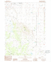
1985 Map of Mount Dome
USGS Topo · Published 1985About this map
Mount Dome dominates this Siskiyou County landscape, rising between the distinct elevations of Big Tableland and Little Tableland. The 1980s terrain is marked by a network of four-wheel-drive tracks connecting remote outposts like Stinson Cabin and the Willow Creek Ranch. Along the northern edge, the Lower Klamath National Wildlife Refuge borders the historic Laird Landing (Site), suggesting an earlier era of water-based transport or settlement at the edge of the wetlands.
Find a feature on this map
23 named features on this map. Tap any name to fly to it.
Don’t see what you’re looking for? This feature index may not catch every label — zoom into the map to look around manually.
Map Details
Editions of this 1985 Mount Dome Map
This is the sole edition of this map. No revisions or reprints were ever made.
Other maps of this area

1886 · Modoc Lava Bed
USGS Topo · 1:250,000

1892 · Modoc Lava-Bed
USGS Topo · 1:250,000

1950 · Mt. Dome
USGS Topo · 1:62,500

1950 · Bray
USGS Topo · 1:62,500

1950 · Dorris
USGS Topo · 1:62,500

1952 · Medicine Lake
USGS Topo · 1:62,500

1954 · Alturas
USGS Topo · 1:250,000

1958 · Alturas
USGS Topo · 1:250,000

1962 · Alturas
USGS Topo · 1:250,000

1965 · Alturas
USGS Topo · 1:250,000