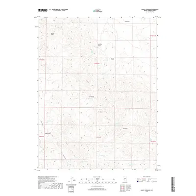
2018 Map of Mount Ferguson
USGS Topo · Published 2018About this map
Mt Ferguson dominates the southern reaches of the Gabbs Valley Range in this Mineral County survey. The landscape is defined by its arid drainage systems, including the long descent of Petrified Wash and the complex topography of The Narrows. For those interested in the passage of early travelers, the route along Rabbit Springs Rd skirts the western edge of the mountains, passing near the high-elevation Rhyolite Pass.
Find a feature on this map
27 named features on this map. Tap any name to fly to it.
Don’t see what you’re looking for? This feature index may not catch every label — zoom into the map to look around manually.
Map Details
Editions of this 2018 Mount Ferguson Map
This is the sole edition of this map. No revisions or reprints were ever made.
Other maps of this area

1909 · Hawthorne
USGS Topo · 1:250,000

1911 · Hawthorne
USGS Topo · 1:250,000

1915 · Hawthorne
USGS Topo · 1:250,000

1948 · Walker Lake
USGS Topo · 1:250,000

1957 · Walker Lake
USGS Topo · 1:250,000

1962 · Walker Lake
USGS Topo · 1:250,000

1964 · Walker Lake
USGS Topo · 1:250,000
1979 · Indian Head Peak
USGS Topo · 1:24,000
1979 · Ramsey Spring
USGS Topo · 1:24,000
1979 · Win Wan Flat
USGS Topo · 1:24,000