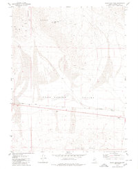
1979 Map of Indian Head Peak
USGS Topo · Published 1980About this map
Indian Head Peak dominates the northern horizon of this Mineral County landscape, anchoring the eastern extent of the Gillis Range. The terrain drops sharply from these high ridges into the broad, arid expanse of Soda Spring Valley, where the Southern Pacific railroad creates a stark linear boundary across the desert floor. This corridor reflects the industrial activity of the late 1970s, with multiple Borrow Pits and a Borrow Pit located adjacent to the tracks, likely used for rail maintenance and local construction.
Find a feature on this map
21 named features on this map. Tap any name to fly to it.
Don’t see what you’re looking for? This feature index may not catch every label — zoom into the map to look around manually.
Map Details
Editions of this 1979 Indian Head Peak Map
This is the sole edition of this map. No revisions or reprints were ever made.
Other maps of this area

1909 · Hawthorne
USGS Topo · 1:250,000

1911 · Hawthorne
USGS Topo · 1:250,000

1915 · Hawthorne
USGS Topo · 1:250,000

1948 · Walker Lake
USGS Topo · 1:250,000

1957 · Walker Lake
USGS Topo · 1:250,000

1962 · Walker Lake
USGS Topo · 1:250,000

1964 · Walker Lake
USGS Topo · 1:250,000

1967 · Pamlico
USGS Topo · 1:24,000

1967 · Mina NW
USGS Topo · 1:24,000
1967 · Mable Mountain
USGS Topo · 1:24,000