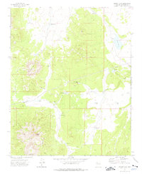
1973 Map of Mount Floyd
USGS Topo · Published 1976About this map
Mount Floyd and Round Mtn dominate this high-elevation Coconino County landscape during the early 1970s. The region is defined by a sparse ranching and utility network, where water management is critical for survival in the arid terrain. A series of named basins such as Malpais Tank, Buster Brown Tank, and Shucking Tank are distributed across the drainage of Partridge Creek, supporting local operations near the Bishop Place settlement.
Find a feature on this map
19 named features on this map. Tap any name to fly to it.
Don’t see what you’re looking for? This feature index may not catch every label — zoom into the map to look around manually.
Map Details
Editions of this 1973 Mount Floyd Map
This is the sole edition of this map. No revisions or reprints were ever made.
Other maps of this area

1886 · Chino
USGS Topo · 1:250,000

1891 · Chino
USGS Topo · 1:250,000

1948 · Williams
USGS Topo · 1:250,000

1954 · Williams
USGS Topo · 1:250,000

1956 · Williams
USGS Topo · 1:250,000

1960 · Williams
USGS Topo · 1:250,000

1961 · Williams
USGS Topo · 1:250,000
1973 · Eagle Nest Mtn
USGS Topo · 1:24,000
1973 · Horse Trap Mesa
USGS Topo · 1:24,000
1973 · Crookton
USGS Topo · 1:24,000