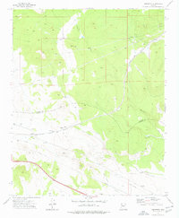
1973 Map of Crookton
USGS Topo · Published 1977About this map
The Coconino Co Yavapai Co border runs through this high-country landscape, where the infrastructure of Western transit and livestock management dominates the terrain. Centered on the Crookton (Site), the map captures the transition of the regional rail corridor as the Atchison Topeka and Santa Fe railroad snakes across the landscape, paralleled by an Old Railroad Grade that marks an earlier path through the hills. This is a region defined by water scarcity and industrial extraction, evidenced by numerous Quarries and water catchment features like Garrett Tank and Gleed Tank. In the south, the presence of Pene Az and a small Cem near Pineveta Wash offer clues for genealogists tracking early ranching or rail-related settlements in this high-desert environment.
Find a feature on this map
21 named features on this map. Tap any name to fly to it.
Don’t see what you’re looking for? This feature index may not catch every label — zoom into the map to look around manually.
Map Details
Editions of this 1973 Crookton Map
This is the sole edition of this map. No revisions or reprints were ever made.
Other maps of this area

1886 · Chino
USGS Topo · 1:250,000

1891 · Chino
USGS Topo · 1:250,000

1947 · Picacho Butte
USGS Topo · 1:62,500

1947 · Turkey Canyon
USGS Topo · 1:62,500

1948 · Williams
USGS Topo · 1:250,000

1948 · Picacho Butte
USGS Topo · 1:63,360

1950 · Turkey Canyon
USGS Topo · 1:62,500

1950 · Picacho Butte
USGS Topo · 1:62,500

1954 · Williams
USGS Topo · 1:250,000

1956 · Williams
USGS Topo · 1:250,000