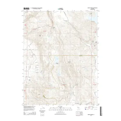
2015 Map of Mount George
USGS Topo · Published 2015About this map
Mount George and the towering Twin Sisters dominate this topography along the border of Napa and Solano counties. The landscape is defined by a series of north-south running ridges and valleys, hosting a network of reservoirs including Lake Curry, Lake Madigan, and Lake Frey. In the southeast, the residential and agricultural reaches of Green Valley extend toward the hills, while the higher elevations feature prominent landmarks like Jenkins Rock and the Sugarloaf peak.
Find a feature on this map
80 named features on this map. Tap any name to fly to it.
Don’t see what you’re looking for? This feature index may not catch every label — zoom into the map to look around manually.
Map Details
Editions of this 2015 Mount George Map
This is the sole edition of this map. No revisions or reprints were ever made.
Other maps of this area

1896 · Carquinez Strait
USGS Topo · 1:62,500

1898 · Karquines
USGS Topo · 1:62,500

1901 · Karquines
USGS Topo · 1:62,500

1902 · Napa
USGS Topo · 1:125,000

1916 · Mare Island
USGS Topo · 1:62,500

1921 · Mt. Vaca
USGS Topo · 1:62,500

1940 · Carquinez Strait
USGS Topo · 1:62,500

1942 · Mare Island
USGS Topo · 1:62,500

1942 · Carquinez
USGS Topo · 1:62,500

1942 · Sonoma
USGS Topo · 1:62,500