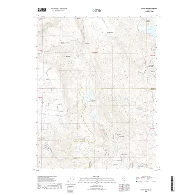
2018 Map of Mount George
USGS Topo · Published 2018About this map
Wooden Valley and Green Valley anchor this 2018 survey of the California Coast Ranges, where the boundary between Napa Co and Solano Co cuts through a landscape defined by prominent peaks and vital water catchments. The terrain rises sharply to summits like Mt George and the Twin Sisters, while the lowlands are characterized by agricultural valleys and several significant reservoirs including Lake Curry, Lake Frey, and the Suisun Reservoir. This geography reveals a sophisticated 21st-century water management system and an extensive network of recreational trails, such as the Skyline Trail and the Napa Solano Ridge Trail, which weave through Wild Horse Valley and around Sugarloaf. The map captures the interface of established ranching tradition in Gordon Valley with modern conservation and utility infrastructure, providing a precise record of these interior coastal hills at the decade's end.
Find a feature on this map
90 named features on this map. Tap any name to fly to it.
Don’t see what you’re looking for? This feature index may not catch every label — zoom into the map to look around manually.
Map Details
Editions of this 2018 Mount George Map
This is the sole edition of this map. No revisions or reprints were ever made.
Other maps of this area

1896 · Carquinez Strait
USGS Topo · 1:62,500

1898 · Karquines
USGS Topo · 1:62,500

1901 · Karquines
USGS Topo · 1:62,500

1902 · Napa
USGS Topo · 1:125,000

1916 · Mare Island
USGS Topo · 1:62,500

1921 · Mt. Vaca
USGS Topo · 1:62,500

1940 · Carquinez Strait
USGS Topo · 1:62,500

1942 · Mare Island
USGS Topo · 1:62,500

1942 · Carquinez
USGS Topo · 1:62,500

1942 · Sonoma
USGS Topo · 1:62,500