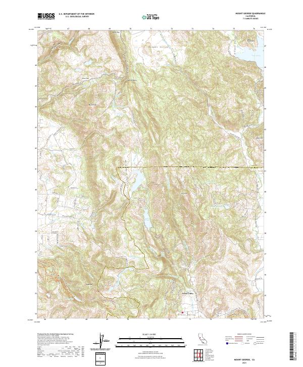
2021 Map of Mount George
USGS Topo · Published 2021About this map
Green Valley serves as a primary point of settlement in this landscape of canyons and high ridges along the border of Napa and Solano Counties. The terrain is defined by a complex network of narrow valleys and high points, including Mt George and the Twin Sisters peaks. Significant water management is evident through several reservoirs and lakes such as Suisun Reservoir, Lake Curry, and Lake Frey. To the west, the slopes are crisscrossed by a dense network of recreational paths like the Bay Area Ridge Trail and Skyline Trail near Sugarloaf.
Find a feature on this map
95 named features on this map. Tap any name to fly to it.
Don’t see what you’re looking for? This feature index may not catch every label — zoom into the map to look around manually.
Map Details
Editions of this 2021 Mount George Map
This is the sole edition of this map. No revisions or reprints were ever made.
Other maps of this area

1896 · Carquinez Strait
USGS Topo · 1:62,500

1898 · Karquines
USGS Topo · 1:62,500

1901 · Karquines
USGS Topo · 1:62,500

1902 · Napa
USGS Topo · 1:125,000

1916 · Mare Island
USGS Topo · 1:62,500

1921 · Mt. Vaca
USGS Topo · 1:62,500

1940 · Carquinez Strait
USGS Topo · 1:62,500

1942 · Mare Island
USGS Topo · 1:62,500

1942 · Carquinez
USGS Topo · 1:62,500

1942 · Sonoma
USGS Topo · 1:62,500