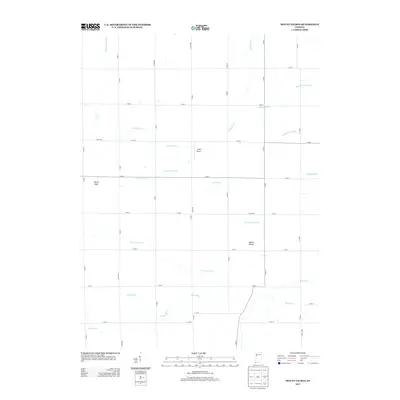
2013 Map of Mount Gilboa
USGS Topo · Published 2013About this map
Mount Gilboa and Mount Nebo rise as subtle elevations above the engineered landscape of Jasper County in this 2013 survey. The terrain is defined by a dense network of agricultural waterways, including the Big Pine Cr and numerous man-made channels like Ferry Ditch and Kirkpatrick Ditch. This grid-based drainage system, featuring names like Hollingsworth Ditch and Mason Eastburn Ditch, reflects over a century of land management designed to transform these Indiana prairies into productive farmland.
Find a feature on this map
43 named features on this map. Tap any name to fly to it.
Don’t see what you’re looking for? This feature index may not catch every label — zoom into the map to look around manually.
Map Details
Editions of this 2013 Mount Gilboa Map
This is the sole edition of this map. No revisions or reprints were ever made.
Other maps of this area

1953 · Danville
USGS Topo · 1:250,000

1955 · Danville
USGS Topo · 1:250,000

1956 · Danville
USGS Topo · 1:250,000

1962 · Mount Gilboa
USGS Topo · 1:24,000
1962 · Round Grove
USGS Topo · 1:24,000

1962 · Wadena
USGS Topo · 1:24,000

1962 · Templeton NE
USGS Topo · 1:24,000

1962 · Templeton
USGS Topo · 1:24,000

1962 · Goodland
USGS Topo · 1:24,000
1962 · Fowler
USGS Topo · 1:24,000