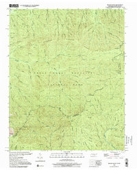
2000 Map of Mount Guyot
USGS Topo · Published 2001About this map
Great Smoky Mountains National Park dominates this high-altitude survey along the Tennessee and North Carolina border. The terrain is defined by the high crest of the Great Smoky Mountains, where the Appalachian National Scenic Trail traverses a series of prominent peaks including Mount Guyot, Mt Chapman, and Mt Sequoyah. This high-elevation wilderness remains largely inaccessible by road, preserved in a state of natural transition where numerous prongs and branches, such as Middle Prong Little Pigeon River and Bradley Fork, begin their descent from the drainage divides.
Find a feature on this map
97 named features on this map. Tap any name to fly to it.
Don’t see what you’re looking for? This feature index may not catch every label — zoom into the map to look around manually.
Map Details
Editions of this 2000 Mount Guyot Map
This is the sole edition of this map. No revisions or reprints were ever made.
Other maps of this area

1893 · Mt Guyot
USGS Topo · 1:125,000

1912 · Mt Guyot
USGS Topo · 1:125,000

1935 · Newport
USGS Topo · 1:48,000

1935 · Hartford
USGS Topo · 1:24,000

1935 · English Mountain
USGS Topo · 1:48,000

1935 · Jones Cove
USGS Topo · 1:24,000

1935 · Richardson Cove
USGS Topo · 1:24,000

1936 · Bunches Bald
USGS Topo · 1:24,000
1936 · Ravensford
USGS Topo · 1:24,000
1936 · Cartertown
USGS Topo · 1:24,000