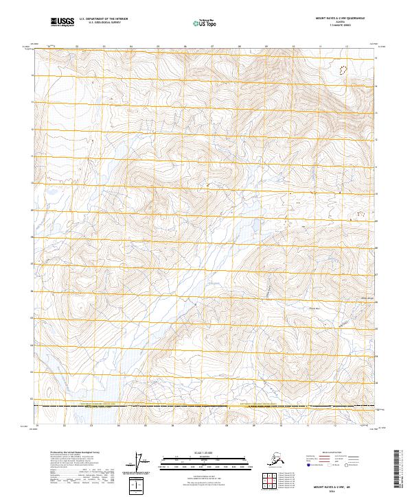
2024 Map of Mount Hayes A-2 NW
USGS Topo · Published 2024About this map
Chistochina River headwaters dominate this high-elevation landscape within the southern slopes of the Alaska Range. This 2024 U.S. Geological Survey data illustrates a complex drainage system where the West Fork Chistochina River and the main channel carve through steep topography marked by glacial and fluvial erosion. The map provides precise detail of the high-country terrain, including several notable geographic cuts such as Miller Gulch, Ruby Gulch, and Powell Gulch. Crossing between high peaks, Chisna Pass provides a natural corridor toward the Chisna River drainage. This survey reflects the modern boundary between the Southeast Fairbanks Census Area and Copper River Census Area, a region defined by its hydrography and high mountain passes rather than permanent settlements or road networks.
Find a feature on this map
19 named features on this map. Tap any name to fly to it.
Don’t see what you’re looking for? This feature index may not catch every label — zoom into the map to look around manually.
Map Details
Editions of this 2024 Mount Hayes A-2 NW Map
This is the sole edition of this map. No revisions or reprints were ever made.
Other maps of this area

1950 · Mount Hayes
USGS Topo · 1:250,000

1950 · Mount Hayes A-3
USGS Topo · 1:63,360

1951 · Mount Hayes
USGS Topo · 1:250,000

1952 · Mount Hayes A-3
USGS Topo · 1:63,360
1954 · Mount Hayes A-3
USGS Topo · 1:63,360
1955 · Mount Hayes A-2
USGS Topo · 1:63,360

1955 · Mount Hayes B-3
USGS Topo · 1:63,360

1955 · Mount Hayes B-2
USGS Topo · 1:63,360

1955 · Mount Hayes
USGS Topo · 1:250,000
2016 · Mount Hayes A-3 SE
USGS Topo · 1:25,000