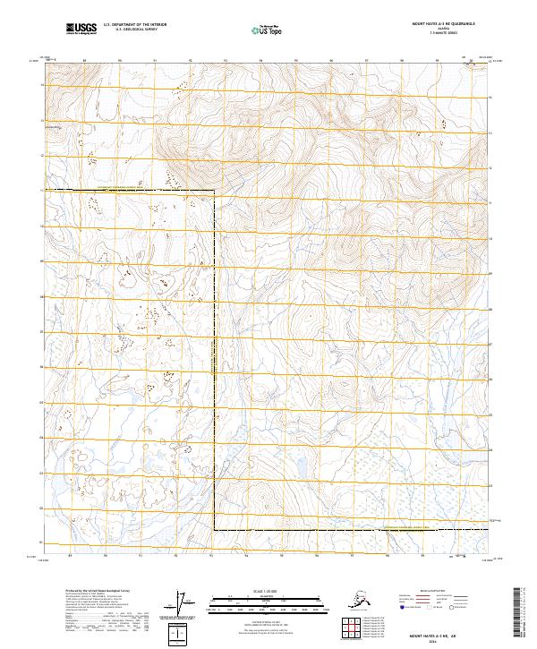
2024 Map of Mount Hayes A-3 NE
USGS Topo · Published 2024About this map
The Alaska Range defines the high elevation and complex drainage patterns of this subarctic interior landscape. High-relief terrain dominates the northern half of the quadrangle, while a network of braided glacial streams and wetlands occupies the lower elevations. The western portion of the map is defined by the headwaters and valley of the Gakona River, which winds through the townships of t20s r13e and t21s r13e. To the east, the West Fork Chistochina River provides a parallel drainage system, highlighting the natural corridors formed by glacial runoff. A significant political boundary bisects the region, marking the transition between the Southeast Fairbanks Census Area and the Copper River Census Area. This topographic study emphasizes the physical geography of the Copper River Basin before it enters more inhabited regions to the south.
Find a feature on this map
11 named features on this map. Tap any name to fly to it.
Don’t see what you’re looking for? This feature index may not catch every label — zoom into the map to look around manually.
Map Details
Editions of this 2024 Mount Hayes A-3 NE Map
This is the sole edition of this map. No revisions or reprints were ever made.
Other maps of this area

1950 · Mount Hayes
USGS Topo · 1:250,000

1950 · Mount Hayes A-3
USGS Topo · 1:63,360

1951 · Mount Hayes
USGS Topo · 1:250,000

1952 · Mount Hayes A-3
USGS Topo · 1:63,360
1954 · Mount Hayes A-3
USGS Topo · 1:63,360
1955 · Mount Hayes A-2
USGS Topo · 1:63,360

1955 · Mount Hayes B-3
USGS Topo · 1:63,360

1955 · Mount Hayes B-2
USGS Topo · 1:63,360

1955 · Mount Hayes
USGS Topo · 1:250,000
2016 · Mount Hayes A-3 SE
USGS Topo · 1:25,000