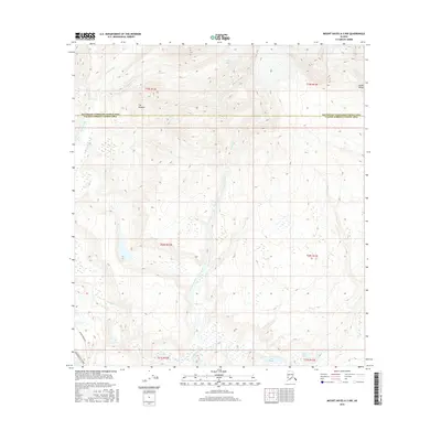
2016 Map of Mount Hayes A-3 NW
USGS Topo · Published 2016About this map
The Alaska Pipeline corridors through this high-altitude landscape of the Alaska Range during the mid-2010s, running parallel to the Richardson Highway at the western edge of the quadrangle. This region serves as a critical transit point where infrastructure meets the glacial environment of the eastern interior. The terrain is defined by the College Glacier and the distinctive formations of The Hoodoos, which dominate the northern sections. Glacial meltwater feeds a complex network of streams, including the Gulkana River, College Creek, and Gunn Creek. In the south, the landscape opens into the Gunn Lakes and the northern tip of Summit Lake. This area marks the boundary between the Southeast Fairbanks Census Area and the Valdez-Cordova Census Area, illustrating the intersection of modern energy transport and traditional Alaskan wilderness.
Find a feature on this map
20 named features on this map. Tap any name to fly to it.
Don’t see what you’re looking for? This feature index may not catch every label — zoom into the map to look around manually.
Map Details
Editions of this 2016 Mount Hayes A-3 NW Map
This is the sole edition of this map. No revisions or reprints were ever made.
Other maps of this area

1949 · Mount Hayes A-4
USGS Topo · 1:63,360

1950 · Mount Hayes
USGS Topo · 1:250,000

1950 · Mount Hayes A-3
USGS Topo · 1:63,360

1951 · Mount Hayes
USGS Topo · 1:250,000

1952 · Mount Hayes A-3
USGS Topo · 1:63,360

1952 · Mount Hayes A-4
USGS Topo · 1:63,360

1952 · Mount Hayes B-4
USGS Topo · 1:63,360

1954 · Mount Hayes B-4
USGS Topo · 1:63,360
1954 · Mount Hayes A-3
USGS Topo · 1:63,360

1955 · Mount Hayes B-3
USGS Topo · 1:63,360