
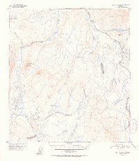
1952 Map of Mount Hayes A-4
USGS Topo · Published 1952About this map
Isabel Pass serves as the central focal point of this high-altitude landscape, where the headwaters of the Delta River and the Gulkana River diverge. This 1952 edition documents the critical corridor of the Richardson Highway as it winds past glacial lakes and alpine terrain, providing a look at mid-century transit through the interior. Notable roadside landmarks include the Richardson Mon and the Summit Lodge, reflecting the sparse but vital human footprint in this subarctic environment.
Find a feature on this map
23 named features on this map. Tap any name to fly to it.
Don’t see what you’re looking for? This feature index may not catch every label — zoom into the map to look around manually.
Map Details
Editions of this 1952 Mount Hayes A-4 Map
2 editions found
Other maps of this area

1949 · Mount Hayes A-4
USGS Topo · 1:63,360

1949 · Gulkana D-3
USGS Topo · 1:63,360

1949 · Mount Hayes A-5
USGS Topo · 1:63,360

1950 · Mount Hayes
USGS Topo · 1:250,000

1950 · Gulkana D-4
USGS Topo · 1:63,360

1950 · Mount Hayes A-3
USGS Topo · 1:63,360

1951 · Gulkana
USGS Topo · 1:250,000

1951 · Mount Hayes
USGS Topo · 1:250,000

1951 · Mt. Hayes B-5
USGS Topo · 1:63,360

1951 · Gulkana D-5
USGS Topo · 1:63,360