
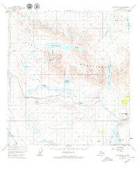
1949 Map of Mount Hayes A-5
USGS Topo · Published 1973About this map
Amphitheater Mountains dominate this high-altitude Alaskan landscape, where the Denali Highway winds across the Valley floor toward Maclaren Summit. Mapped from aerial photographs taken in 1949, the terrain illustrates a complex hydrological network defined by glacial recession, featuring the massive Sevenmile Lake and the interconnected Tangle Lakes system. The map records specific geological and geographic markers such as Landmark Gap, a significant natural pass, and glacial features like Tarn Valley and Houseblock Valley. To the south, the Maclaren River and Tangle River drain the high country, while remote triangulation stations like VABM 4372 Wild and VABM 4716 Boulder denote the primary survey points used to chart this wilderness. This edition captures the corridor before significant modern development, preserving the original path of the road and the natural state of water bodies like Phalarope Lake and Downwind Lake.
Find a feature on this map
27 named features on this map. Tap any name to fly to it.
Don’t see what you’re looking for? This feature index may not catch every label — zoom into the map to look around manually.
Map Details
Editions of this 1949 Mount Hayes A-5 Map
2 editions found
Other maps of this area

1949 · Mount Hayes A-4
USGS Topo · 1:63,360

1950 · Mount Hayes
USGS Topo · 1:250,000

1950 · Gulkana D-4
USGS Topo · 1:63,360

1950 · Mount Hayes A-6
USGS Topo · 1:63,360

1951 · Gulkana
USGS Topo · 1:250,000

1951 · Mount Hayes
USGS Topo · 1:250,000

1951 · Gulkana D-6
USGS Topo · 1:63,360

1951 · Mount Hayes B-6
USGS Topo · 1:63,360

1951 · Mt. Hayes B-5
USGS Topo · 1:63,360

1951 · Gulkana D-5
USGS Topo · 1:63,360