
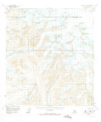
1951 Map of Mount Hayes B-6
USGS Topo · Published 1960About this map
Maclaren Glacier dominates the eastern edge of this mid-century topographic record, feeding the south-flowing Maclaren River through a high-altitude wilderness. The drainage network is clearly defined by the East Fork Susitna River and the West Fork Maclaren River, revealing a landscape shaped by ice and water. Evidence of human activity in this remote region is sparse but significant, centered on a lone Cabin and Landing Strips situated near the riverbanks. Geodetic control points like VABM East Fork and VABM Coal indicate the primary survey work conducted by the U.S. Geological Survey and the Bureau of Land Management. The presence of numerous Crevasses across the high snowfields underscores the dynamic and unstable nature of the glacial terrain during the early 1950s.
Find a feature on this map
14 named features on this map. Tap any name to fly to it.
Don’t see what you’re looking for? This feature index may not catch every label — zoom into the map to look around manually.
Map Details
Editions of this 1951 Mount Hayes B-6 Map
2 editions found
Other maps of this area

1949 · Healy A-1
USGS Topo · 1:63,360

1949 · Mount Hayes A-5
USGS Topo · 1:63,360

1950 · Mount Hayes
USGS Topo · 1:250,000

1950 · Healy B-1
USGS Topo · 1:63,360

1950 · Mount Hayes A-6
USGS Topo · 1:63,360

1951 · Healy
USGS Topo · 1:250,000

1951 · Mount Hayes
USGS Topo · 1:250,000

1951 · Healy C-1
USGS Topo · 1:63,360

1951 · Mount Hayes C-5
USGS Topo · 1:63,360

1951 · Mt. Hayes B-5
USGS Topo · 1:63,360