
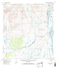
1950 Map of Mount Hayes A-6
USGS Topo · Published 1974About this map
The Clearwater Mountains dominate this 1950s interior landscape, where glacial runoff feeds a complex network of waterways including the Maclaren River and Clearwater Creek. This region reflects a mid-century transition in Alaskan wilderness accessibility, centered around the Denali Highway. The map captures essential infrastructure for early travelers and locals, such as a Lodge near the river and a Campground along the lower creeks.
Find a feature on this map
17 named features on this map. Tap any name to fly to it.
Don’t see what you’re looking for? This feature index may not catch every label — zoom into the map to look around manually.
Map Details
Editions of this 1950 Mount Hayes A-6 Map
2 editions found
Other maps of this area

1949 · Healy A-1
USGS Topo · 1:63,360

1949 · Mount Hayes A-5
USGS Topo · 1:63,360

1950 · Talkeetna Mountains
USGS Topo · 1:250,000

1950 · Mount Hayes
USGS Topo · 1:250,000

1950 · Healy B-1
USGS Topo · 1:63,360

1951 · Healy
USGS Topo · 1:250,000

1951 · Gulkana
USGS Topo · 1:250,000

1951 · Mount Hayes
USGS Topo · 1:250,000

1951 · Gulkana D-6
USGS Topo · 1:63,360

1951 · Mount Hayes B-6
USGS Topo · 1:63,360