
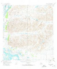
1949 Map of Healy A-1
USGS Topo · Published 1968About this map
The Clearwater Mountains dominate this 1949 survey of the Matanuska-Susitna region, a landscape defined by glacial drainage and early infrastructure. The settlement of Denali sits near the upper reaches of the West Fork Susitna River, serving as a remote outpost in a territory marked by gold-mining history. High-elevation features like Gold Hill and Lucky Hill rise above Valdez Creek, while the Denali Highway cuts through the southern valleys near Alpine Creek.
Find a feature on this map
46 named features on this map. Tap any name to fly to it.
Don’t see what you’re looking for? This feature index may not catch every label — zoom into the map to look around manually.
Map Details
Editions of this 1949 Healy A-1 Map
2 editions found
Other maps of this area

1949 · Healy B-2
USGS Topo · 1:63,360

1950 · Talkeetna Mountains
USGS Topo · 1:250,000

1950 · Mount Hayes
USGS Topo · 1:250,000

1950 · Healy B-1
USGS Topo · 1:63,360

1950 · Mount Hayes A-6
USGS Topo · 1:63,360

1951 · Healy
USGS Topo · 1:250,000

1951 · Gulkana
USGS Topo · 1:250,000

1951 · Mount Hayes
USGS Topo · 1:250,000

1951 · Gulkana D-6
USGS Topo · 1:63,360

1951 · Mount Hayes B-6
USGS Topo · 1:63,360