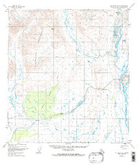
1950 Map of Mt. Hayes A-6
USGS Topo · Published 1988About this map
The Clearwater Mountains define the northern reaches of this interior landscape, where the braided channels of the Maclaren River and West Fork navigate a complex basin of glacial lakes and marshy lowlands. Surveyed at mid-century, the map documents a transition in transportation as the Denali Highway cuts through the southern terrain, providing access to the remote wilderness near Crazy Notch. Evidence of seasonal travel and early infrastructure is visible through the presence of a Sled Road and the established Campground near Oso Creek. The isolation of the era is underscored by the sparse human footprints, including a lonely Lodge and scattered family-named water bodies like Petrokov Lake and Glaser Lake. These features together reveal a region being mapped just as modern road access began to alter its historical character.
Find a feature on this map
19 named features on this map. Tap any name to fly to it.
Don’t see what you’re looking for? This feature index may not catch every label — zoom into the map to look around manually.
Map Details
Editions of this 1950 Mt. Hayes A-6 Map
2 editions found
Other maps of this area

1949 · Healy A-1
USGS Topo · 1:63,360

1949 · Mount Hayes A-5
USGS Topo · 1:63,360

1950 · Talkeetna Mountains
USGS Topo · 1:250,000

1950 · Mount Hayes
USGS Topo · 1:250,000

1950 · Healy B-1
USGS Topo · 1:63,360

1950 · Mount Hayes A-6
USGS Topo · 1:63,360

1951 · Healy
USGS Topo · 1:250,000

1951 · Gulkana
USGS Topo · 1:250,000

1951 · Mount Hayes
USGS Topo · 1:250,000

1951 · Gulkana D-6
USGS Topo · 1:63,360