
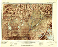
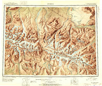
1949 Map of Mount Hayes A-5
USGS Topo · Published 1979About this map
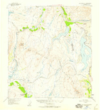
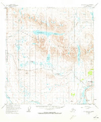
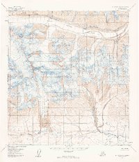
The Amphitheater Mountains dominate this 1949 topographic landscape, a high-altitude wilderness where glacial action carved deep basins like Sevenmile Lake and Landmark Gap Lake. The terrain is characterized by a complex network of waterways, including the Maclaren River and the southern extent of the Tangle Lakes system, including Upper Tangle Lake and Round Tangle Lake.
Find a feature on this map
23 named features on this map. Tap any name to fly to it.
Don’t see what you’re looking for? This feature index may not catch every label — zoom into the map to look around manually.
Map Details
Editions of this 1949 Mount Hayes A-5 Map
2 editions found
Other maps of this area
1949 · Mount Hayes A-4
USGS Topo · 1:63,360
1949 · Mount Hayes A-5
USGS Topo · 1:63,360

1950 · Mount Hayes
USGS Topo · 1:250,000
1950 · Gulkana D-4
USGS Topo · 1:63,360
1950 · Mount Hayes A-6
USGS Topo · 1:63,360
1951 · Gulkana
USGS Topo · 1:250,000
1951 · Mount Hayes
USGS Topo · 1:250,000
1951 · Gulkana D-6
USGS Topo · 1:63,360
1951 · Mount Hayes B-6
USGS Topo · 1:63,360
1951 · Mt. Hayes B-5
USGS Topo · 1:63,360