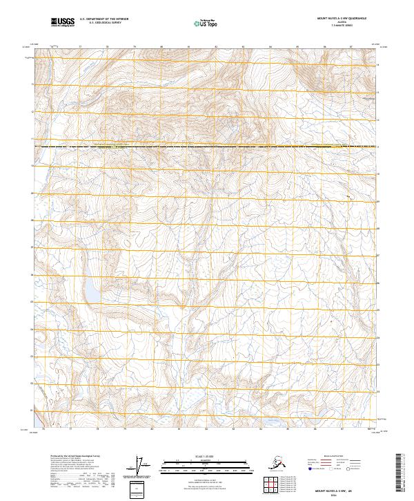
2024 Map of Mount Hayes A-3 NW
USGS Topo · Published 2024About this map
The Alaska Pipeline cuts a distinct industrial path through the western edge of this high-latitude terrain, marking a critical piece of 20th-century energy infrastructure. This landscape is defined by the high peaks of the Alaska Range and a complex drainage network where the Gulkana River and Phelan Creek flow through the valleys. The boundary between the Southeast Fairbanks and Copper River Census Areas bisects the region, reflecting the administrative divisions of this sparsely populated interior. Local water features such as College Creek and the Gunn Lakes offer specific points of reference for those studying the hydrology of the eastern Alaska Range. This 2024 data highlights the intersection of modern utility corridors with a traditional wilderness environment.
Find a feature on this map
15 named features on this map. Tap any name to fly to it.
Don’t see what you’re looking for? This feature index may not catch every label — zoom into the map to look around manually.
Map Details
Editions of this 2024 Mount Hayes A-3 NW Map
This is the sole edition of this map. No revisions or reprints were ever made.
Other maps of this area

1949 · Mount Hayes A-4
USGS Topo · 1:63,360

1950 · Mount Hayes
USGS Topo · 1:250,000

1950 · Mount Hayes A-3
USGS Topo · 1:63,360

1951 · Mount Hayes
USGS Topo · 1:250,000

1952 · Mount Hayes A-3
USGS Topo · 1:63,360

1952 · Mount Hayes A-4
USGS Topo · 1:63,360

1952 · Mount Hayes B-4
USGS Topo · 1:63,360

1954 · Mount Hayes B-4
USGS Topo · 1:63,360
1954 · Mount Hayes A-3
USGS Topo · 1:63,360

1955 · Mount Hayes B-3
USGS Topo · 1:63,360