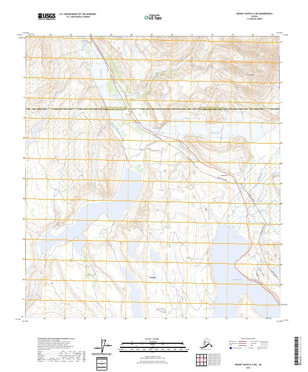
2024 Map of Mount Hayes A-4 NE
USGS Topo · Published 2024About this map
Paxson serves as a critical junction in this high-altitude landscape where the Richardson Highway meets the Fielding Lake Road. The terrain is dominated by the massive peaks of the Alaska Range, with Isabel Pass providing a vital transit corridor through the mountains. Running parallel to the highway, the Alaska Pipeline cuts a distinct industrial path through the wilderness, crossing drainage systems like Phelan Creek and McCallum Creek.
Find a feature on this map
22 named features on this map. Tap any name to fly to it.
Don’t see what you’re looking for? This feature index may not catch every label — zoom into the map to look around manually.
Map Details
Editions of this 2024 Mount Hayes A-4 NE Map
This is the sole edition of this map. No revisions or reprints were ever made.
Other maps of this area

1949 · Mount Hayes A-4
USGS Topo · 1:63,360

1950 · Mount Hayes
USGS Topo · 1:250,000

1950 · Mount Hayes A-3
USGS Topo · 1:63,360

1951 · Mount Hayes
USGS Topo · 1:250,000

1952 · Mount Hayes A-3
USGS Topo · 1:63,360

1952 · Mount Hayes A-4
USGS Topo · 1:63,360

1952 · Mount Hayes B-4
USGS Topo · 1:63,360

1954 · Mount Hayes B-4
USGS Topo · 1:63,360
1954 · Mount Hayes A-3
USGS Topo · 1:63,360

1955 · Mount Hayes B-3
USGS Topo · 1:63,360