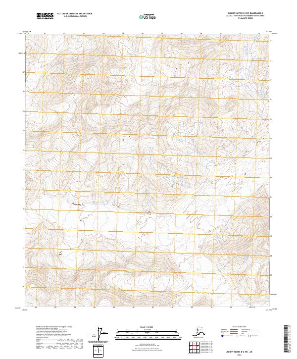
2024 Map of Mount Hayes B-2 SW
USGS Topo · Published 2024About this map
Steep, high-elevation terrain characterizes this Southeast Fairbanks Census Area landscape, where vertical relief is the primary geographic feature. The terrain is organized by the Public Land Survey System, specifically dividing the area into T18s R14e, T18s R15e, and T18s R16e in the north, transitioning to T19s R14e, T19s R15e, and T19s R16e further south. Produced by the U.S. Geological Survey, this map provides a detailed study of land contours and drainage patterns in an area of Alaska where human infrastructure and named settlements are absent, focusing instead on the geometry of the land and the precise boundaries of federal survey divisions.
Find a feature on this map
6 named features on this map. Tap any name to fly to it.
Don’t see what you’re looking for? This feature index may not catch every label — zoom into the map to look around manually.
Map Details
Editions of this 2024 Mount Hayes B-2 SW Map
This is the sole edition of this map. No revisions or reprints were ever made.
Other maps of this area

1950 · Mount Hayes
USGS Topo · 1:250,000

1950 · Mount Hayes A-3
USGS Topo · 1:63,360

1951 · Mount Hayes
USGS Topo · 1:250,000

1952 · Mount Hayes A-3
USGS Topo · 1:63,360
1954 · Mount Hayes A-3
USGS Topo · 1:63,360
1955 · Mount Hayes A-2
USGS Topo · 1:63,360

1955 · Mount Hayes B-3
USGS Topo · 1:63,360

1955 · Mount Hayes B-2
USGS Topo · 1:63,360

1955 · Mount Hayes
USGS Topo · 1:250,000
2016 · Mount Hayes B-3 NE
USGS Topo · 1:25,000