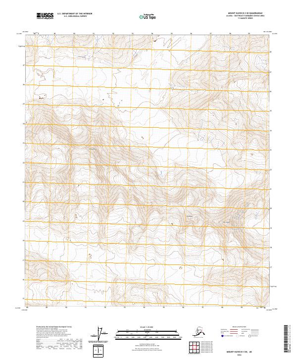
2024 Map of Mount Hayes B-3 SE
USGS Topo · Published 2024About this map
Mt Gakona dominates the northwestern section of this high-altitude landscape in the Southeast Fairbanks Census Area. The terrain is characterized by its severe verticality, with steep ridgelines and deep drainage basins defining the interior. Notable peaks such as Thorkona and the descriptive The Thorn serve as primary navigational anchors in a region largely devoid of human structures or permanent settlements. The map demonstrates the complex topography of the Alaska Range, where elevation contours reveal a series of sharp summits and narrow passes. The absence of roads or developed trails underscores the isolation of these peaks, which remain a significant focus for geographical study and wilderness navigation within the state's interior.
Find a feature on this map
7 named features on this map. Tap any name to fly to it.
Don’t see what you’re looking for? This feature index may not catch every label — zoom into the map to look around manually.
Map Details
Editions of this 2024 Mount Hayes B-3 SE Map
This is the sole edition of this map. No revisions or reprints were ever made.
Other maps of this area

1950 · Mount Hayes
USGS Topo · 1:250,000

1950 · Mount Hayes A-3
USGS Topo · 1:63,360

1951 · Mount Hayes
USGS Topo · 1:250,000

1952 · Mount Hayes A-3
USGS Topo · 1:63,360
1954 · Mount Hayes A-3
USGS Topo · 1:63,360
1955 · Mount Hayes A-2
USGS Topo · 1:63,360

1955 · Mount Hayes B-3
USGS Topo · 1:63,360

1955 · Mount Hayes B-2
USGS Topo · 1:63,360

1955 · Mount Hayes
USGS Topo · 1:250,000
2016 · Mount Hayes B-3 NE
USGS Topo · 1:25,000