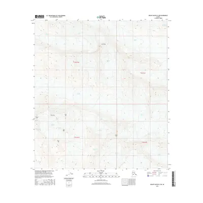
2016 Map of Mount Hayes B-3 SW
USGS Topo · Published 2016About this map
Canwell Glacier and Gulkana Glacier dominate this high-altitude landscape in the Alaska Range, where ice and rock dictate the geography. The map captures a massive glacial network including the Fels Glacier, Johnson Glacier, and the smaller Pegmatite Glacier. These moving ice masses are punctuated by formidable summits such as Institute Peak, Minya Peak, and the descriptive Snow White. The complex glacial morphology is further defined by features like the Gabriel Icefall and Moore Icefall, which feed into the valley systems. This 2016 survey illustrates the perennial ice coverage and the headwaters of W Phelan Cr, providing a detailed look at the drainage patterns and peaks within the unorganized borough that remain largely untouched by human infrastructure or permanent settlement.
Find a feature on this map
23 named features on this map. Tap any name to fly to it.
Don’t see what you’re looking for? This feature index may not catch every label — zoom into the map to look around manually.
Map Details
Editions of this 2016 Mount Hayes B-3 SW Map
This is the sole edition of this map. No revisions or reprints were ever made.
Other maps of this area

1949 · Mount Hayes A-4
USGS Topo · 1:63,360

1950 · Mount Hayes
USGS Topo · 1:250,000

1950 · Mount Hayes A-3
USGS Topo · 1:63,360

1951 · Mount Hayes
USGS Topo · 1:250,000

1952 · Mount Hayes A-3
USGS Topo · 1:63,360

1952 · Mount Hayes A-4
USGS Topo · 1:63,360

1952 · Mount Hayes B-4
USGS Topo · 1:63,360

1954 · Mount Hayes B-4
USGS Topo · 1:63,360
1954 · Mount Hayes A-3
USGS Topo · 1:63,360

1955 · Mount Hayes B-3
USGS Topo · 1:63,360