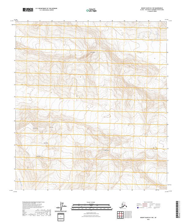
2024 Map of Mount Hayes B-3 SW
USGS Topo · Published 2024About this map
Pegmatite Glacier sits at the heart of this high-elevation terrain within the Mount Hayes region, defining the local glacial landscape as it flows toward the western reaches of the survey. The topography is dominated by a cluster of named summits, including the prominent Snow White in the north and a central group of peaks such as Skull Peak and Icefall Peak. These landmarks, alongside Minya Peak and Ogive Mtn, create a complex network of ridges and basins that guide the drainage patterns of the area.
Find a feature on this map
12 named features on this map. Tap any name to fly to it.
Don’t see what you’re looking for? This feature index may not catch every label — zoom into the map to look around manually.
Map Details
Editions of this 2024 Mount Hayes B-3 SW Map
This is the sole edition of this map. No revisions or reprints were ever made.
Other maps of this area

1949 · Mount Hayes A-4
USGS Topo · 1:63,360

1950 · Mount Hayes
USGS Topo · 1:250,000

1950 · Mount Hayes A-3
USGS Topo · 1:63,360

1951 · Mount Hayes
USGS Topo · 1:250,000

1952 · Mount Hayes A-3
USGS Topo · 1:63,360

1952 · Mount Hayes A-4
USGS Topo · 1:63,360

1952 · Mount Hayes B-4
USGS Topo · 1:63,360

1954 · Mount Hayes B-4
USGS Topo · 1:63,360
1954 · Mount Hayes A-3
USGS Topo · 1:63,360

1955 · Mount Hayes B-3
USGS Topo · 1:63,360