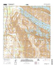
2016 Map of Mount Hayes B-4 SE
USGS Topo · Published 2016About this map
Alaska Pipeline and the Richardson Highway parallel each other through this glacial corridor, marking a critical infrastructure passage through the Alaska Range. This modern survey illustrates the proximity of massive ice fields to these vital transport lines, with the Fels Glacier and Canwell Glacier dominating the high eastern elevations. The drainage patterns of Phelan Creek and the Delta River define the valley floor, fed by glacial melt from sources like McCallum Glacier and the W Gulkana Glacier. High peaks such as Rainbow Mtn and the adjacent Rainbow Ridge provide a vertical backdrop to the engineering corridor below. This sheet captures the intersection of industrial logistics and an active glacial landscape, providing a record of the terrain as it existed in the early twenty-first century.
Find a feature on this map
20 named features on this map. Tap any name to fly to it.
Don’t see what you’re looking for? This feature index may not catch every label — zoom into the map to look around manually.
Map Details
Editions of this 2016 Mount Hayes B-4 SE Map
This is the sole edition of this map. No revisions or reprints were ever made.
Other maps of this area

1949 · Mount Hayes A-4
USGS Topo · 1:63,360

1950 · Mount Hayes
USGS Topo · 1:250,000

1950 · Mount Hayes A-3
USGS Topo · 1:63,360

1951 · Mount Hayes
USGS Topo · 1:250,000

1952 · Mount Hayes A-3
USGS Topo · 1:63,360

1952 · Mount Hayes A-4
USGS Topo · 1:63,360

1952 · Mount Hayes B-4
USGS Topo · 1:63,360

1954 · Mount Hayes B-4
USGS Topo · 1:63,360
1954 · Mount Hayes A-3
USGS Topo · 1:63,360

1955 · Mount Hayes B-3
USGS Topo · 1:63,360