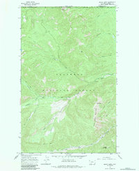
1966 Map of Mount Hefty
USGS Topo · Published 1984About this map
Flathead National Forest defines this high-elevation wilderness along the international boundary between Canada and the United States. Surveyed in the mid-1960s, the terrain is dominated by a series of prominent peaks and deep drainage basins, including Mount Hefty and the ridgeline of Cleft Rock Mountain. A network of pack trails serves as the primary infrastructure for the area, connecting remote observation points like the Thoma Lookout and the Hornet Mountain Lookout.
Find a feature on this map
25 named features on this map. Tap any name to fly to it.
Don’t see what you’re looking for? This feature index may not catch every label — zoom into the map to look around manually.
Map Details
Editions of this 1966 Mount Hefty Map
2 editions found
Other maps of this area

1906 · Kintla Lakes
USGS Topo · 1:125,000

1913 · Stryker
USGS Topo · 1:125,000

1916 · Stryker
USGS Topo · 1:125,000

1938 · Kintla Lakes
USGS Topo · 1:125,000

1957 · Kalispell
USGS Topo · 1:250,000

1960 · Kalispell
USGS Topo · 1:250,000

1961 · Kalispell
USGS Topo · 1:250,000

1966 · Red Meadow Lake
USGS Topo · 1:24,000

1966 · Mount Hefty
USGS Topo · 1:24,000
1966 · Mount Thompson-Seton
USGS Topo · 1:24,000