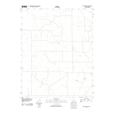
2010 Map of Mount Helen
USGS Topo · Published 2010About this map
Mount Helen and its surrounding plains in Beaver County are defined by a network of drainage systems that cross the landscape of the Oklahoma Panhandle. The area is dominated by the meandering path of Fivemile Creek, which spans the central and southern portions of the map, while Twomile Creek and Big Sandy Creek navigate the northern reaches. This 2010 survey illustrates a primarily rural environment characterized by a rigid section-line road system, including routes like AA Rd and 31 Rd. A notable man-made water feature, Wells Reservoir, sits in the southeast, serving as a critical point of water storage in this arid region. The map captures the quiet character of the high plains, showing the sparse distribution of structures and the reliance on local creek beds for geographic orientation.
Find a feature on this map
10 named features on this map. Tap any name to fly to it.
Don’t see what you’re looking for? This feature index may not catch every label — zoom into the map to look around manually.
Map Details
Editions of this 2010 Mount Helen Map
This is the sole edition of this map. No revisions or reprints were ever made.
Other maps of this area

1892 · Meade
USGS Topo · 1:125,000

1896 · Ashland
USGS Topo · 1:125,000

1954 · Perryton
USGS Topo · 1:250,000

1955 · Woodward
USGS Topo · 1:250,000

1955 · Pratt
USGS Topo · 1:250,000

1955 · Dodge City
USGS Topo · 1:250,000

1958 · Perryton
USGS Topo · 1:250,000

1958 · Woodward
USGS Topo · 1:250,000

1958 · Dodge City
USGS Topo · 1:250,000

1959 · Pratt
USGS Topo · 1:250,000