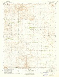
1972 Map of Mount Helen
USGS Topo · Published 1974About this map
The Old Indian Treaty Boundary carves a significant historical line through this high plains landscape at the border of Kansas and Oklahoma. This 1970s survey captures a region defined by its hydrology and mineral extraction, where the prominent height of Mount Helen overlooks a network of watercourses including Fivemile Creek, Twomile Creek, and Sandy Creek. The terrain is marked by the presence of industrial infrastructure, specifically a Pipeline and numerous scattered sites labeled Gas Well, alongside a Caliche Pit and a notable Drill Hole. These features illustrate the mid-century transition of the southern Great Plains as traditional ranching and land boundaries integrated with modern energy development. Natural water sources like Springs and a man-made Reservoir further emphasize the critical nature of water management in this arid transition zone between Clark and Meade counties.
Find a feature on this map
16 named features on this map. Tap any name to fly to it.
Don’t see what you’re looking for? This feature index may not catch every label — zoom into the map to look around manually.
Map Details
Editions of this 1972 Mount Helen Map
This is the sole edition of this map. No revisions or reprints were ever made.
Other maps of this area

1892 · Meade
USGS Topo · 1:125,000

1896 · Ashland
USGS Topo · 1:125,000

1954 · Perryton
USGS Topo · 1:250,000

1955 · Woodward
USGS Topo · 1:250,000

1955 · Pratt
USGS Topo · 1:250,000

1955 · Dodge City
USGS Topo · 1:250,000

1958 · Perryton
USGS Topo · 1:250,000

1958 · Woodward
USGS Topo · 1:250,000

1958 · Dodge City
USGS Topo · 1:250,000

1959 · Pratt
USGS Topo · 1:250,000