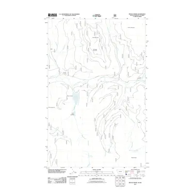
2011 Map of Mount Henry
USGS Topo · Published 2011About this map
Boyd Mill Cemetery sits in the northwest corner of this terrain, a point of interest for genealogists tracing family names in this corner of Lincoln County. The landscape is defined by the high elevations of Mount Henry, Caribou Mountain, and Grubstake Mountain, which overlook a complex network of waterways. Water management is evident at Okaga Lake, where both the Okaga Lake Dam and Shellys Hope Dam regulate the flow of Windy Creek.
Find a feature on this map
26 named features on this map. Tap any name to fly to it.
Don’t see what you’re looking for? This feature index may not catch every label — zoom into the map to look around manually.
Map Details
Editions of this 2011 Mount Henry Map
This is the sole edition of this map. No revisions or reprints were ever made.
Other maps of this area

1957 · Kalispell
USGS Topo · 1:250,000

1960 · Kalispell
USGS Topo · 1:250,000

1961 · Kalispell
USGS Topo · 1:250,000

1963 · Yaak
USGS Topo · 1:24,000

1963 · Robinson Mountain
USGS Topo · 1:24,000

1963 · Boulder Lakes
USGS Topo · 1:24,000

1963 · Bonnet Top
USGS Topo · 1:24,000

1963 · Mount Henry
USGS Topo · 1:24,000

1963 · Lost Horse Mountain
USGS Topo · 1:24,000

1979 · Yaak River
USGS Topo · 1:100,000