
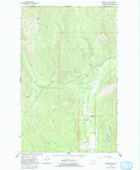
1963 Map of Bonnet Top
USGS Topo · Published 1966About this map
The Kootenai National Forest dominates this 1963 survey, where the international boundary between Canada and the United States meets the dividing line of the Kootenay District and Lincoln County. The landscape is defined by the convergence of the Yaak River and the West Fork Yaak River, a critical drainage system surrounded by high points like Bonnet Top and Dusty Peak.
Find a feature on this map
25 named features on this map. Tap any name to fly to it.
Don’t see what you’re looking for? This feature index may not catch every label — zoom into the map to look around manually.
Map Details
Editions of this 1963 Bonnet Top Map
2 editions found
Other maps of this area

1957 · Kalispell
USGS Topo · 1:250,000

1960 · Kalispell
USGS Topo · 1:250,000

1961 · Kalispell
USGS Topo · 1:250,000

1963 · Yaak
USGS Topo · 1:24,000

1963 · Garver Mountain
USGS Topo · 1:24,000

1963 · Clark Mountain
USGS Topo · 1:24,000

1963 · Mount Henry
USGS Topo · 1:24,000

1963 · Lost Horse Mountain
USGS Topo · 1:24,000

1979 · Yaak River
USGS Topo · 1:100,000
1997 · Clark Mountain
USGS Topo · 1:24,000