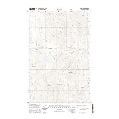
2014 Map of Mount Henry
USGS Topo · Published 2014About this map
The Kootenai National Forest dominates this section of northwest Montana, where a complex network of peaks and drainage systems defines the landscape. Major summits like Caribou Mtn, Wood Mtn, and Grubstake Mtn tower over the valleys of the Yaak River and its various tributaries, including Solo Joe Cr and Windy Cr. The map captures a moment of modern forest management, showing established routes such as Natl Forest Develop Road 746 Rd and Yaak River Rd that provide access through the dense Parcell Mountains. Local history is anchored by the Boyd Mill Cem, one of the few named cultural landmarks in this wilderness. Water features are abundant throughout the high country, from the secluded Okaga Lake to the high-elevation Mount Henry Lakes situated just below the peak of Mt Henry.
Find a feature on this map
28 named features on this map. Tap any name to fly to it.
Don’t see what you’re looking for? This feature index may not catch every label — zoom into the map to look around manually.
Map Details
Editions of this 2014 Mount Henry Map
This is the sole edition of this map. No revisions or reprints were ever made.
Other maps of this area

1957 · Kalispell
USGS Topo · 1:250,000

1960 · Kalispell
USGS Topo · 1:250,000

1961 · Kalispell
USGS Topo · 1:250,000

1963 · Yaak
USGS Topo · 1:24,000

1963 · Robinson Mountain
USGS Topo · 1:24,000

1963 · Boulder Lakes
USGS Topo · 1:24,000

1963 · Bonnet Top
USGS Topo · 1:24,000

1963 · Mount Henry
USGS Topo · 1:24,000

1963 · Lost Horse Mountain
USGS Topo · 1:24,000

1979 · Yaak River
USGS Topo · 1:100,000