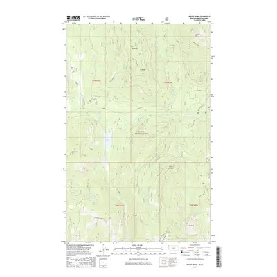
2017 Map of Mount Henry
USGS Topo · Published 2017About this map
Yaak sits at the heart of this high-elevation landscape in the Kootenai National Forest, where the river and mountain terrain dictate the pattern of settlement. Local history is anchored by the Boyd Mill Cem near the riverbanks, while the surrounding peaks of the Purcell Mountains define the horizon. Significant peaks such as Grubstake Mtn, Wood Mtn, and the namesake Mt Henry rise above the drainage systems of the Yaak River and its multiple forks. This area is characterized by a dense network of water features, including the remote Mount Henry Lakes, Okaga Lake, and Fish Lakes. The presence of the Pacific NW National Scenic Trail and the Purcell Summit NRT highlights the transition of this area from a raw timber and mining frontier into a destination for long-distance wilderness travel.
Find a feature on this map
31 named features on this map. Tap any name to fly to it.
Don’t see what you’re looking for? This feature index may not catch every label — zoom into the map to look around manually.
Map Details
Editions of this 2017 Mount Henry Map
This is the sole edition of this map. No revisions or reprints were ever made.
Other maps of this area

1957 · Kalispell
USGS Topo · 1:250,000

1960 · Kalispell
USGS Topo · 1:250,000

1961 · Kalispell
USGS Topo · 1:250,000

1963 · Yaak
USGS Topo · 1:24,000

1963 · Robinson Mountain
USGS Topo · 1:24,000

1963 · Boulder Lakes
USGS Topo · 1:24,000

1963 · Bonnet Top
USGS Topo · 1:24,000

1963 · Mount Henry
USGS Topo · 1:24,000

1963 · Lost Horse Mountain
USGS Topo · 1:24,000

1979 · Yaak River
USGS Topo · 1:100,000