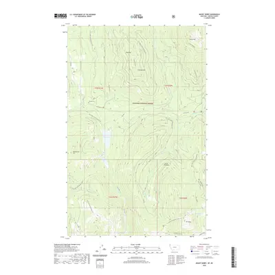
2020 Map of Mount Henry
USGS Topo · Published 2020About this map
Kootenai National Forest dominates this section of Lincoln County, characterized by a complex network of mountain peaks and alpine drainages. The Yaak River and its E Fork Yaak River serve as the primary hydrologic features, carving through the high country where peaks like Caribou Mtn and Grubstake Mtn define the horizon. For those tracing local history, the Boyd Mill Cem represents a rare point of named human heritage in this largely unpopulated wilderness. The terrain is traversed by several forest development roads and the Pacific NW National Scenic Trail, which winds near Mt Henry and the high-elevation Mount Henry Lakes. Numerous smaller water bodies including Okaga Lake and the Fish Lakes cluster are scattered throughout the southern reaches of the Purcell Mountains, illustrating a landscape shaped by glacial activity and remote forest management.
Find a feature on this map
37 named features on this map. Tap any name to fly to it.
Don’t see what you’re looking for? This feature index may not catch every label — zoom into the map to look around manually.
Map Details
Editions of this 2020 Mount Henry Map
This is the sole edition of this map. No revisions or reprints were ever made.
Other maps of this area

1957 · Kalispell
USGS Topo · 1:250,000

1960 · Kalispell
USGS Topo · 1:250,000

1961 · Kalispell
USGS Topo · 1:250,000

1963 · Yaak
USGS Topo · 1:24,000

1963 · Robinson Mountain
USGS Topo · 1:24,000

1963 · Boulder Lakes
USGS Topo · 1:24,000

1963 · Bonnet Top
USGS Topo · 1:24,000

1963 · Mount Henry
USGS Topo · 1:24,000

1963 · Lost Horse Mountain
USGS Topo · 1:24,000

1979 · Yaak River
USGS Topo · 1:100,000