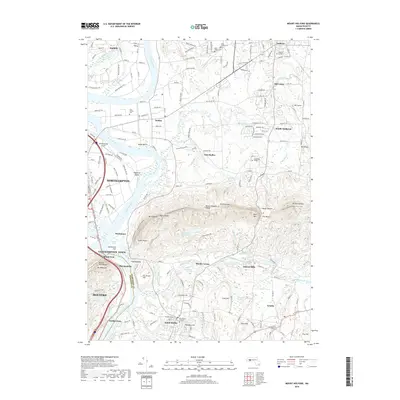
2018 Map of Mount Holyoke
USGS Topo · Published 2018About this map
Amherst College, Hampshire College, and Mt Holyoke College anchor this modern survey of the Pioneer Valley, where the Connecticut River winds through fertile bottomlands like Hockanum Flat. The dramatic geography of the Mount Holyoke Range dominates the center of the sheet, featuring landmarks such as Mt Holyoke, Titans Piazza, and The Notch. This 2018 survey details the transition from the collegiate and residential centers of Amherst and South Hadley to the protected forests along the New England National Scenic Trail. Between these heights and the river, the landscape is dotted with smaller locales like East Hadley and Aldrich Mills, connected by historical routes including Old Ferry Rd and the New England Central Railroad.
Find a feature on this map
188 named features on this map. Tap any name to fly to it.
Don’t see what you’re looking for? This feature index may not catch every label — zoom into the map to look around manually.
Map Details
Editions of this 2018 Mount Holyoke Map
This is the sole edition of this map. No revisions or reprints were ever made.
Other maps of this area

1885 · Northampton
USGS Topo · 1:62,500

1886 · Springfield
USGS Topo · 1:62,500

1886 · Northampton
USGS Topo · 1:62,500

1887 · Palmer
USGS Topo · 1:62,500

1887 · Belchertown
USGS Topo · 1:62,500

1889 · Springfield
USGS Topo · 1:62,500

1889 · Palmer
USGS Topo · 1:62,500

1890 · Belchertown
USGS Topo · 1:62,500

1891 · Northampton
USGS Topo · 1:62,500

1893 · Northampton
USGS Topo · 1:62,500