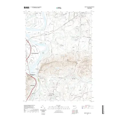
2021 Map of Mount Holyoke
USGS Topo · Published 2021About this map
The Mount Holyoke Range anchors this portrait of the Pioneer Valley, where the Connecticut River carves a path through some of Massachusetts' most prominent academic and agricultural landscapes. The presence of Amherst College, Hampshire College, and Mount Holyoke College underscores the region's long-standing identity as an educational hub. To the west, the river creates distinct geographic features like Shepherd Island and Hockanum Flat, while the settlement of Northampton sits across from the historic farming community of Hadley.
Find a feature on this map
94 named features on this map. Tap any name to fly to it.
Don’t see what you’re looking for? This feature index may not catch every label — zoom into the map to look around manually.
Map Details
Editions of this 2021 Mount Holyoke Map
This is the sole edition of this map. No revisions or reprints were ever made.
Other maps of this area

1885 · Northampton
USGS Topo · 1:62,500

1886 · Springfield
USGS Topo · 1:62,500

1886 · Northampton
USGS Topo · 1:62,500

1887 · Palmer
USGS Topo · 1:62,500

1887 · Belchertown
USGS Topo · 1:62,500

1889 · Springfield
USGS Topo · 1:62,500

1889 · Palmer
USGS Topo · 1:62,500

1890 · Belchertown
USGS Topo · 1:62,500

1891 · Northampton
USGS Topo · 1:62,500

1893 · Northampton
USGS Topo · 1:62,500