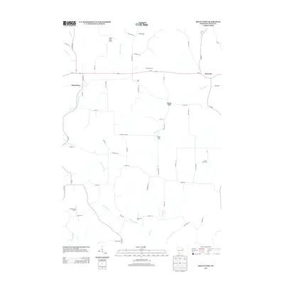
2013 Map of Mount Hope
USGS Topo · Published 2013About this map
Agricultural operations and small villages define this portion of Grant County, where Us-18 connects the communities of Mount Hope and Mount Ida. The landscape is shaped by the drainage patterns of the Little Grant River and Little Green River, which carve through the high ground of Irish Ridge and Little Irish Ridge. This 2013 survey illustrates the modern layout of rural Wisconsin, highlighting numerous named agricultural sites such as Jam Dairy, Hutchinson Farm, and Pleasant Valley Farms. The inclusion of the C. Jeidy Farms Airport in the southwest quadrant suggests the intersection of traditional farming with private aviation infrastructure. Transport routes like State Road 133 and numerous township roads such as Milner Rd and Badger Rd provide a detailed view of the local road network connecting scattered homesteads and the settlement at Shady Dell.
Find a feature on this map
55 named features on this map. Tap any name to fly to it.
Don’t see what you’re looking for? This feature index may not catch every label — zoom into the map to look around manually.
Map Details
Editions of this 2013 Mount Hope Map
This is the sole edition of this map. No revisions or reprints were ever made.
Other maps of this area

1900 · Lancaster
USGS Topo · 1:125,000

1904 · Lancaster
USGS Topo · 1:125,000

1908 · Lancaster
USGS Topo · 1:125,000

1926 · Wauzeka
USGS Topo · 1:62,500

1933 · Boscobel
USGS Topo · 1:62,500

1958 · La Crosse
USGS Topo · 1:250,000

1959 · Dubuque
USGS Topo · 1:250,000

1961 · Dubuque
USGS Topo · 1:250,000

1961 · La Crosse
USGS Topo · 1:250,000

1962 · Dubuque
USGS Topo · 1:250,000