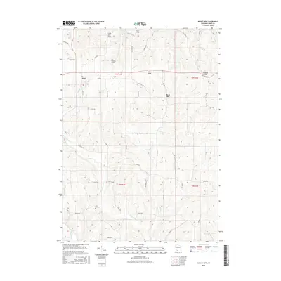
2016 Map of Mount Hope
USGS Topo · Published 2016About this map
Mount Hope and Mount Ida anchor this high-elevation landscape in Grant County, where the topography is defined by the prominent Military Ridge and the steep dissections of Foxboro Hollow. The region’s drainage patterns are complex, with the Little Green River and Little Grant River carving through the plateau while smaller tributaries like Martin Br and Blake Fork define the local valleys. This late-modern survey preserves the locations of several burial grounds essential for family history research, including Casler Cem south of Mount Hope and Borah Cem near Mount Ida. A dense network of local roads, such as Breezy Hill Rd and Meadowbrook Ln, connects the scattered farmsteads across Irish Ridge and Little Irish Ridge, reflecting the area's enduring agricultural character and the way its transportation routes have long been dictated by the high divides and narrow hollows.
Find a feature on this map
55 named features on this map. Tap any name to fly to it.
Don’t see what you’re looking for? This feature index may not catch every label — zoom into the map to look around manually.
Map Details
Editions of this 2016 Mount Hope Map
This is the sole edition of this map. No revisions or reprints were ever made.
Other maps of this area

1900 · Lancaster
USGS Topo · 1:125,000

1904 · Lancaster
USGS Topo · 1:125,000

1908 · Lancaster
USGS Topo · 1:125,000

1926 · Wauzeka
USGS Topo · 1:62,500

1933 · Boscobel
USGS Topo · 1:62,500

1958 · La Crosse
USGS Topo · 1:250,000

1959 · Dubuque
USGS Topo · 1:250,000

1961 · Dubuque
USGS Topo · 1:250,000

1961 · La Crosse
USGS Topo · 1:250,000

1962 · Dubuque
USGS Topo · 1:250,000