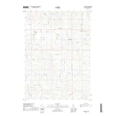
2018 Map of Mount Hope
USGS Topo · Published 2018About this map
Military Ridge serves as a prominent geographic spine for this Grant County landscape, guiding the path of modern transit while dividing the complex drainage systems of the Driftless Area. The high ground around Mount Hope and Mount Ida provides a vantage point over a deeply carved network of valleys, where the Little Green River and Little Grant River wind through the hills. This 2018 survey reveals a rural settlement pattern deeply rooted in the land's hydrology and terrain, with local landmarks like Foxboro Hollow and Little Irish Ridge defining the area's identity.
Find a feature on this map
53 named features on this map. Tap any name to fly to it.
Don’t see what you’re looking for? This feature index may not catch every label — zoom into the map to look around manually.
Map Details
Editions of this 2018 Mount Hope Map
This is the sole edition of this map. No revisions or reprints were ever made.
Other maps of this area

1900 · Lancaster
USGS Topo · 1:125,000

1904 · Lancaster
USGS Topo · 1:125,000

1908 · Lancaster
USGS Topo · 1:125,000

1926 · Wauzeka
USGS Topo · 1:62,500

1933 · Boscobel
USGS Topo · 1:62,500

1958 · La Crosse
USGS Topo · 1:250,000

1959 · Dubuque
USGS Topo · 1:250,000

1961 · Dubuque
USGS Topo · 1:250,000

1961 · La Crosse
USGS Topo · 1:250,000

1962 · Dubuque
USGS Topo · 1:250,000