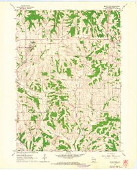
1962 Map of Mount Hope
USGS Topo · Published 1964About this map
Military Ridge and Irish Ridge dominate the landscape of northwestern Grant County, defining the high ground above the dissected valleys of the Little Grant River and Martin Branch. This early 1960s survey illustrates a region shaped by its ridgeline geography, where primary settlements like Mount Hope and Mount Ida follow the east-west corridor of the old military road.
Find a feature on this map
20 named features on this map. Tap any name to fly to it.
Don’t see what you’re looking for? This feature index may not catch every label — zoom into the map to look around manually.
Map Details
Editions of this 1962 Mount Hope Map
This is the sole edition of this map. No revisions or reprints were ever made.
Other maps of this area

1900 · Lancaster
USGS Topo · 1:125,000

1904 · Lancaster
USGS Topo · 1:125,000

1908 · Lancaster
USGS Topo · 1:125,000

1926 · Wauzeka
USGS Topo · 1:62,500

1933 · Boscobel
USGS Topo · 1:62,500

1958 · La Crosse
USGS Topo · 1:250,000

1959 · Dubuque
USGS Topo · 1:250,000

1961 · Dubuque
USGS Topo · 1:250,000

1961 · La Crosse
USGS Topo · 1:250,000

1962 · Dubuque
USGS Topo · 1:250,000