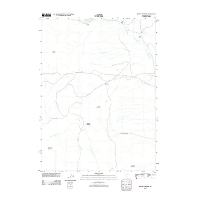
2012 Map of Mount Ichabod
USGS Topo · Published 2012About this map
Mount Ichabod dominates this high-altitude landscape of Elko County, where the upper reaches of the Bruneau River drainage shape the terrain. This 2012 survey documents a sparsely populated ranching territory characterized by established family holdings like the F Shively Ranch, P R Prunty Ranch, and A Torreuil Ranch. These ranching operations are centered around vital water sources such as Mason Creek, Dolly Creek, and the East Fork Beaver Creek.
Find a feature on this map
24 named features on this map. Tap any name to fly to it.
Don’t see what you’re looking for? This feature index may not catch every label — zoom into the map to look around manually.
Map Details
Editions of this 2012 Mount Ichabod Map
This is the sole edition of this map. No revisions or reprints were ever made.
Other maps of this area

1935 · Charleston
USGS Topo · 1:48,000

1942 · Mt. Velma
USGS Topo · 1:62,500

1955 · Wells
USGS Topo · 1:250,000

1958 · Wells
USGS Topo · 1:250,000

1961 · Wells
USGS Topo · 1:250,000

1967 · Stag Mountain
USGS Topo · 1:24,000

1968 · Charleston Reservoir
USGS Topo · 1:24,000
1968 · Marys River Basin NW
USGS Topo · 1:24,000

1971 · Double Mtn
USGS Topo · 1:24,000

1971 · Devils Armchair
USGS Topo · 1:24,000